Comment on this entry | Back to Travel Index | Bicycle Trip Photos | All United States entries
Riding along the US / Mexico border
Jump To: The Plan | General Route | Training | Preparation/Gear | Daily Details | Photos
By Day: Day 1 | Day 2 | Day 3 | Day 4 | Day 5 | Day 6 | Day 7
Leave a comment
The Plan
The plan was to start at the beach in San Diego and head towards Phoenix where my girlfriend would pick me up a week later and drive me back to San Diego. My friend was going to continue on across the United States. The route was chosen using Adventure Cycling Maps. The tentative route was to parallel the 8 Freeway from the coast towards El Centro, then head northeast where we could meet up with I-10 at the CA-AZ border, then head east towards Phoenix. The point where we were to depart each other's company was still uncertain.
[Back to Top]
The Route in brief. More details below
View Larger Map
Training - If you can call it that
The entire trip plan was finalized a mere month before departure, so we didn't really do much training. We rode 2 or 3 days a week for the month leading up, starting the first ride with less than 10 miles and maxing out with a ride at about 30 miles a week or so prior to departure. To put this in perspective, on our first day of the trip we rode about 50 miles, all uphill, heading from the coast up to about 3000' feet. Needless to say we were worn out that night. But it just goes to show that it doesn't take as much prep as you would think to do something like this.
[Back to Top]
Preparation and Gear
As far as cycling gear goes, my friend had decided to spend some money on some quality gear, and justifiably so, since he was prepping for a 4000 mile ride. He purchased a new touring bike, new waterproof front and rear saddlebags, cycling shoes, gloves, tent, sleeping bag, and an assortment of smaller, useful items. I, however, didn't want to spend much money since I'd only be going for a week. So I bought city tires to put on my mountain bike, got a pair of cheap and used saddlebags on Craigslist, and then purchased the minimal gear I'd need (shoes, clips, riding shorts, backpacking tent/sleeping bag). Less than $250 later I was offically ready.
[Back to Top]
The Details by Day
Day 1 - San Diego to Alpine (A to B, map 1)
We left at about 9:30am from Crystal Pier in Pacific Beach after a few goodbyes, and were riding a high heading out of the city. We made some good progress, stopped for a pizza lunch, then hit the road again. Our last 20 miles were a serious uphill battle, and around the time our weary and not yet road accustomed legs nearly gave out, we had completed 50 miles and reached the Ma Tar Awa RV Park just east of the Viejas Casino. We were too late to check in, as the office had already closed, but we saw someone cleaning who let us slip in on the agreement that we would pay our dues in the morning. It wasn't quite dark yet, but being that it was late April and were at an elevation of a few thousand feet, it got chilly quick. There was no dinner to be had anywhere, so we snacked on what was in our packs, set up our tents, and were quickly off to sleep.
[Back to Top]
Day 2 - Alpine to Jacumba (B to C, map 1)
Though the chilly mountain air made waking up difficult, the wild turkeys and their noises made waking necessary. I was a bit slow in rising due to the cold and some sore legs, but eventually we made it to the campground store for some snacks, and then were on the road again. The morning started in much the same way that it ended -- with an uphill climb. We labored uphill until we peaked at around 4200', then cruised into Pine Valley for some lunch. After a solid meal and a serious mental pep talk we headed out. That night we made it into Jacumba, after completing only a mere 40 miles. Not a lot of mileage, but after all that climbing and not enough preparation, we were happy to splurge a bit at the Jacumba Hot Springs Hotel, right next to the Mexican border. We soaked in the hot springs, showered, had dinner and a beer at the hotel diner, and set in for another good night's sleep.
[Back to Top]
Map 1
View Larger Map
Day 3 - Jacumba to Glamis (A to B, map 2)
In the morning, while eating breakfast, we met another cyclist who had come from Northern California and was heading to Arizona. After introductions and some chit chat, it was decided that he would join us for a bit. We prepped for the day, then headed out. The big event for the day was a 3000' drop over 15 miles down into the desert valley, on the freeway shoulder no less. We covered this ground in no time, and put in 40 miles before hitting El Centro for lunch. From there we headed north into the Imperial Valley, through Brawley, and riding a tailwind decided to push towards the Glamis sand dunes. With the sun setting, aching legs, and no campgrounds for miles, we decided to do a bit of renegade camping behind some dunes. It was a 90 mile day and I was hurting, so it felt great to put up the tent and have a dinner that consisted of a 7-11 sandwich and a cherry pie. Not exactly healthy, but after a day like this quite satisfying.
[Back to Top]
Day 4 - Glamis to Blythe (B to C, map 2)
We woke up and rode into Glamis, which consists of exactly one general store containing supplies for the all the people who party and ride their ATVs, dirt bikes, and trucks in the recreation area in the dunes. I had a stellar microwave breakfast there, and stocked up on water since it would be more than 40 miles until the next place of civilization. Even though it was still late April, we were in the desert and daytime temperatures were soaring into the 90s, so water supplies were essential. The ride was long and hot, and for much of it we were passing through the farmland of the Imperial Valley, which is all supported by a series of canals diverted from the Colorado River. After riding 70 miles today, our arrival in Blythe was joyous, and once again we decided to splurge on a hotel where we could cool off. Our new cycling friend who had joined us from Jacumba was leaving our company here, so we celebrated with some margaritas which were made in a blender he was carrying. (He packed a lot of strange items he brought along.)
[Back to Top]
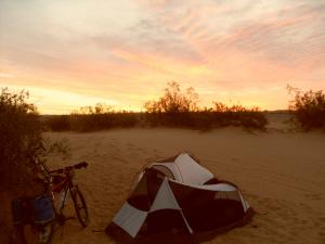
Renegade camping in Glamis sand dunes
Day 5 - Blythe, CA to Vicksburg, AZ (C to D, map 2)
Day five was a pretty mundane day. We crossed into Arizona, and climbed up a small mountain range (along the 10 freeway), eventually making it to Quartzsite for lunch. A small quirky desert town which most of the residents had already left for the summer due to the heat, we found an open bar for lunch, then decided to press on. Dinner was had at a random roadside cafe, which also was getting ready to close down for the summer. With full bellies we pressed East with the sun setting at our backs, and came upon a small RV park just as it was getting too dark to continue riding. We had wanted to renegade camp again, but for some reason there were fences that extended for miles along the road, keeping us from pulling off into the desert shadows to set up camp. We had been told that you can free camp anywhere on BLM (Bureau of Land Management) land, but due to the fence we couldn't get off the road. So this RV park couldn't have come at a more perfect time. It was a hot day, and we completed 50 miles.
[Back to Top]
Day 6 - Vicksburg to Wickenburg (D to E, map 2)
Today was another average day. The desert scenery was pretty consistent, and it was hot again. We made it into a town called Aguila for lunch, and spent a couple hours cooling off at the local libary. After lunch it was time to say goodbye to my friend, as he was heading northeast, and I needed to head back south towards Phoenix where my girlfriend would be waiting. I made it about 70 miles today, and rode into Wickenburg where I found a hotel with a pool and a hot tub to spend the night in. I knew it was my last night, and since I was alone I opted for a nice place where I could lounge in comfort. An ironic side note here is that even after close to 350 miles of riding, I decided to shower and then hop back onto my bike and ride into town to grab dinner. I guess this meant that I was really getting used to all the cycling.
[Back to Top]
Day 7 - Wickenburg to Phoenix (E to F, map 2)
The road into Phoenix was pretty crappy. The shoulder was filled with glass and debris, there wasn't much room to ride, and since it was just a two lane highway there was traffic pretty much the entire way. It was probably only 20 miles or so before I started hitting the outskirts of the city, but eventually I was able to pick up the bike path that cuts across the city, and could ultimately take me all the way to Tempe. It was actually pretty bittersweet riding into the city knowing it would be my last day before returning home. I had tried to locate a couple potential hotels the day prior so I would have a general direction to go when I got into the city. The place I had selected was all the way on the far side of the city, so I headed there, and of course it had no rooms left when I arrived. Not knowing what to do from there, and since my girlfriend wasn't in town yet to rescue me, I did what only seemed natural after making it this far by bike. I hopped back on the saddle and happily headed back west, again towards the center of Phoenix that I had only an hour ago ridden through. I found a main street with a wide selection of hotels, and decided to consider my trip complete. I stopped in a parking lot, and waited for my girlfriend to find me. My butt was happy to be off the bike, but inside I was secretly wishing I could have still been following the open road with my friend, and I mentally wished him luck and a good tailwind for the remainder of his trip. So it was here in Phoenix that my adventure ended. And it was certainly nice to spend a few bike-free days relaxing in Arizona before heading back to San Diego. On that final day I rode about 65 miles, plus the few extra that I backtracked ... you know, just for fun.
[Back to Top | Photos]
Map 2
View Larger Map
[Back to Top]
- Leave a comment or some feedback!
- Get free updates by email!
- Liking Idealist Cafe on Facebook is a good option
- Get more frequent and random updates on Twitter
- You can add Idealist Cafe to your feed reader
- Feel free to drop me a line any of those places and introduce yourself!
San Diego to Phoenix cycling trip photos
If you would like to use these photos, please see the copyright info. Thanks!
 Packed and ready to go for 7 day bike trip
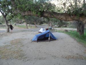 Camping the first night at Ma Tar Awa campground near Viejas after riding 65 miles uphill
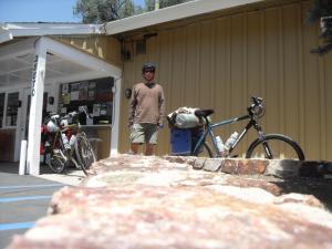 Lunch break in Pine Valley
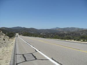 The view looking back heading over the mountains
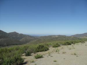 Looking west, near the summit
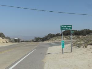 Tecate Divide, the first of many summits
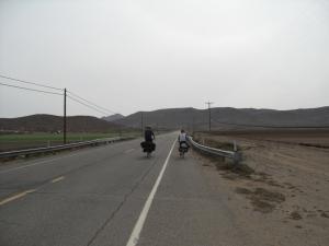
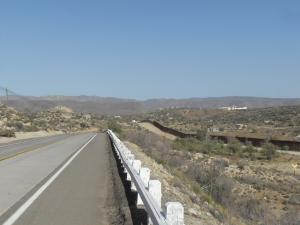 Near Jacumba and the United States / Mexico border fenceRiding along the US / Mexico border
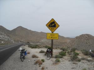 Before a 15 mile descent into Imperial Valley ... on the freeway
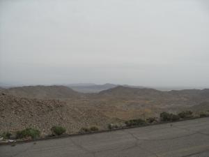 Long and winding downhill into Imperial Valley
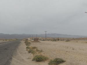 Welcome to Plaster City, California
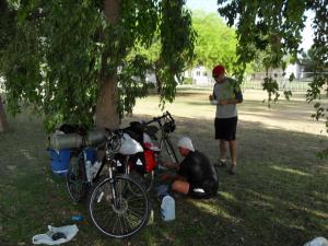 Taking a break in Brawley, CA
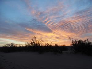 Sunset in GlamisRenegade camping in Glamis sand dunes
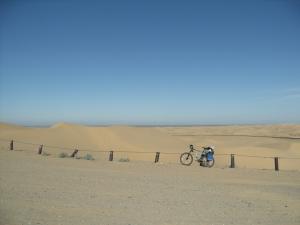 My bike in the Glamis sand dunes
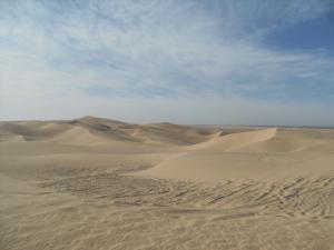 Glamis sand dunes. So peaceful.
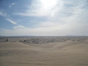 More Glamis sand dunes
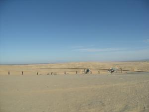 Our bicycles with the dunes in the background
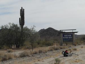 Your now beyond Hope. Arizona. Spelling error and all.
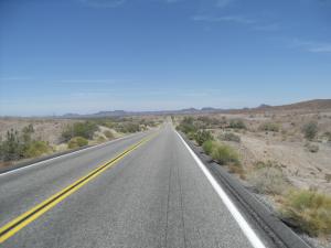 Riding on the long open desert road, Arizona
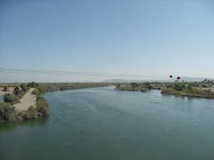 Crossing the Colorado River by bicycle
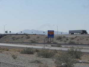 Now entering Arizona by bicycle
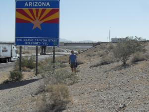 Me crossing Arizona border on bike
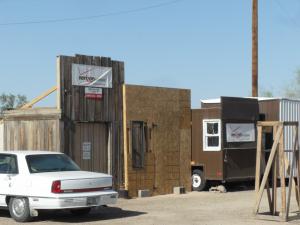 Verizon store, Quartzsite, Arizona
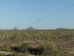 Beautiful Sonoran Desert, Arizona
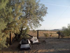 Camping in an RV park for $5, middle of nowhere, Arizona

